(A) 啊! 的博客
中國悠久的曆史裏,戰爭不論在時間上或在社會上都占有相當重要的地位。就在這個戰鬥不斷的國家裏,克敵製勝的戰術研究相當興盛。


正文
NASA的LRO探測器於北京時間12月25日11時52分49秒,在離月麵約150公裏高度,拍攝到嫦娥三號著陸器和月球車“玉兔”,像素精度1.5米。著陸點精確位置44.1214°N,340.4884°E,位於一個直徑約450米(深40米)的隕石坑以東約60米的地方。

The rover is only about 150 cm wide, yet it shows up in the NAC images for two reasons: the solar panels are very effective at reflecting light so the rover shows up as two bright pixels, and the Sun is setting thus the rover casts a distinct shadow (as does the lander). Since the rover is close to the size of a pixel, how can we be sure we are seeing the rover and not a comparably sized boulder? Fortuitously, the NAC acquired a "before" image (M1127248516R) of the landing site, with nearly identical lighting, on 30 June 2013. By comparing the before and after landing site images, the LROC team confirmed the position of the lander and rover, and derived accurate map coordinates for the lander (44.1214°N, 340.4884°E, -2640 meters elevation).
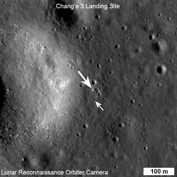
LROC NAC view of the Chang'e 3 lander (large arrow) and rover (small arrow) just before sunset on their first day of lunar exploration. LROC NAC M1142582775R, image width 576 m, north is up [NASA/GSFC/Arizona State University].
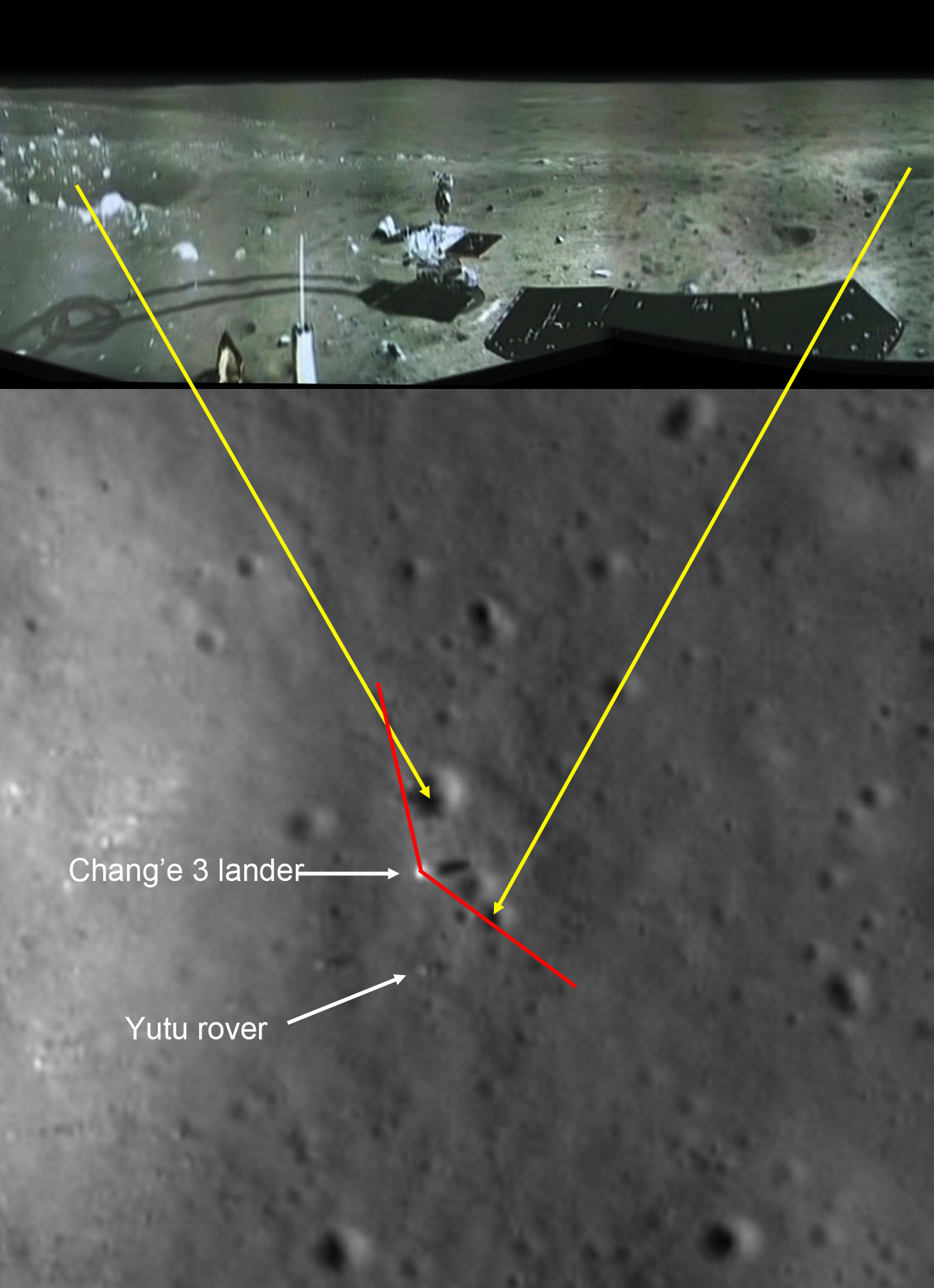
Chang'e 3 landed on Mare Imbrium (Sea of Rains) just east of a 450 m diameter impact crater on 14 December 2013. Soon after landing, a small rover named Yutu (or Jade Rabbit in English) was deployed and took its first tentative drive onto the airless regolith. At the time of the landing LRO's orbit was far from the landing site so images of the landing were not possible. Ten days later on 24 December, LRO approached the landing site, and LROC was able to acquire a series of six LROC Narrow Angle Camera (NAC) image pairs during the next 36 hours (19 orbits). The highest resolution image was possible when LRO was nearly overhead on 25 December 03:52:49 UT (24 December 22:52:49 EST). At this time LRO was at an altitude of ~150 km above the site, and the pixel size was 150 cm.
The lander set down about 60 meters east of the rim of a 450 meter diameter impact crater (40 meters deep) on a thick deposit of volcanic materials. A large scale wrinkle ridge (~100 km long, 10 km wide) cuts across the area and was formed as tectonic stress caused the volcanic layers to buckle and break along faults. Wrinkle ridges are common on the Moon, Mercury and Mars.
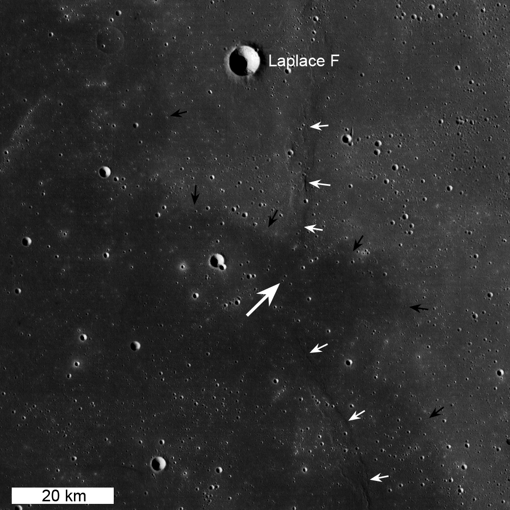
LROC WAC context mosaic for the Chang'e 3 landing site (large white arrow); small white arrows indicate wrinkle ridge and small black arrows delimit boundary between "red" mare (northeast) and "blue" mare (southwest), image is 100 km wide [NASA/GSFC/Arizona State University]. Lunar mare basalts are divided into two main spectral (color) types: "red" and "blue" (blue is perhaps a misnomer, think "less red"). Basalts on the Moon (same on Earth) are composed mainly of two minerals, pyroxene and plagioclase, though olivine and ilmenite can sometimes occur in significant amounts. The presence of ilmenite (FeTiO3) results in lower reflectance and a "less-red" color - thus the blue basalts. The landing site is on a blue mare (higher titanium) thought to be about 3.0 billion years old. The boundary (black arrows in above WAC mosaic) with an older (3.5 billion years) red mare is only 10 km to the north.
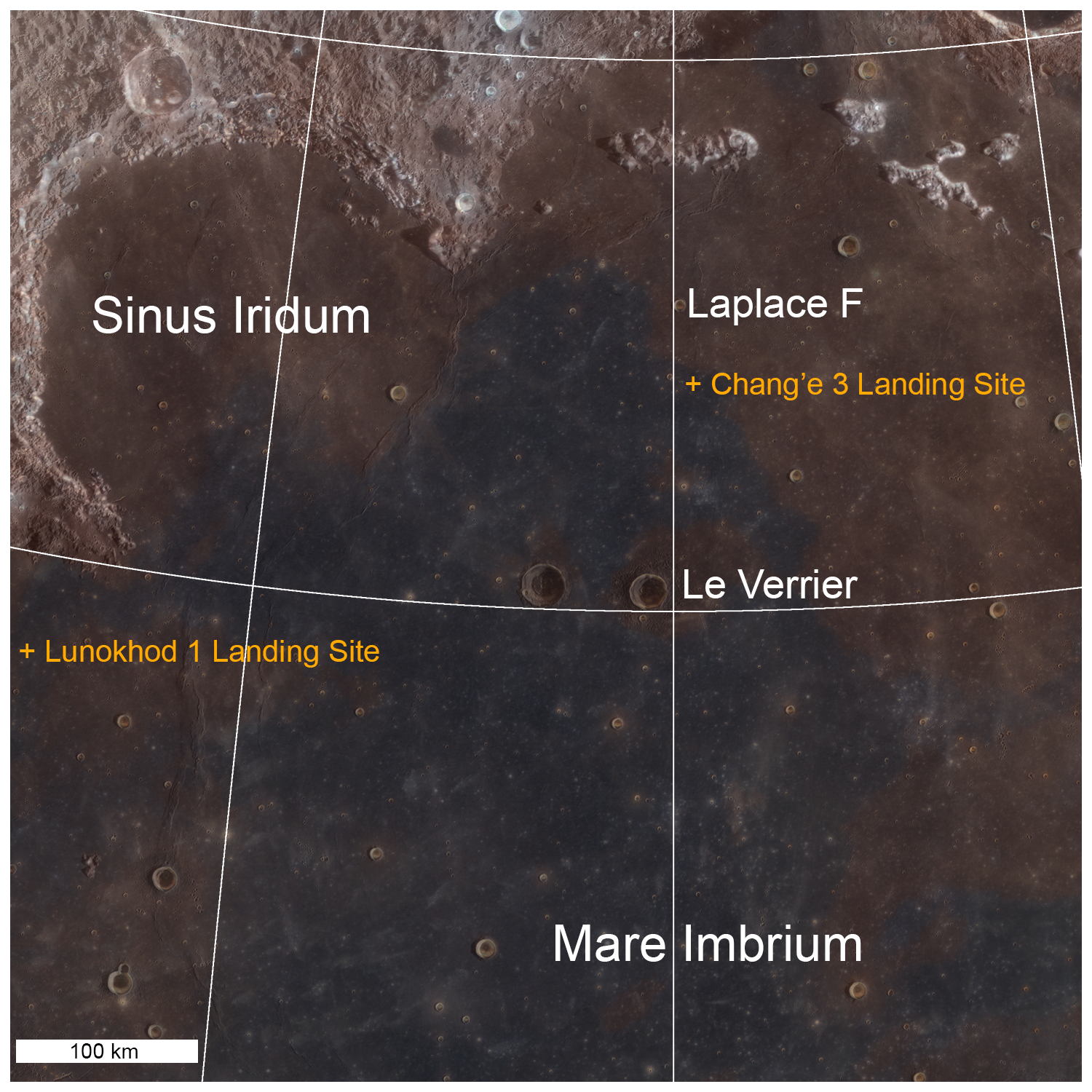
LROC WAC color (689 nm, 415 nm, 321 nm) overlain on WAC sunset BW image. Note the proximity of the landing site to a contact between red and blue maria [NASA/GSFC/Arizona State University].
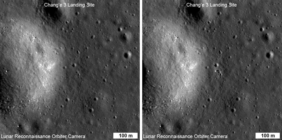
LROC NAC before and after shown in the animation at the top of this Featured Image [NASA/GSFC/Arizona State University].
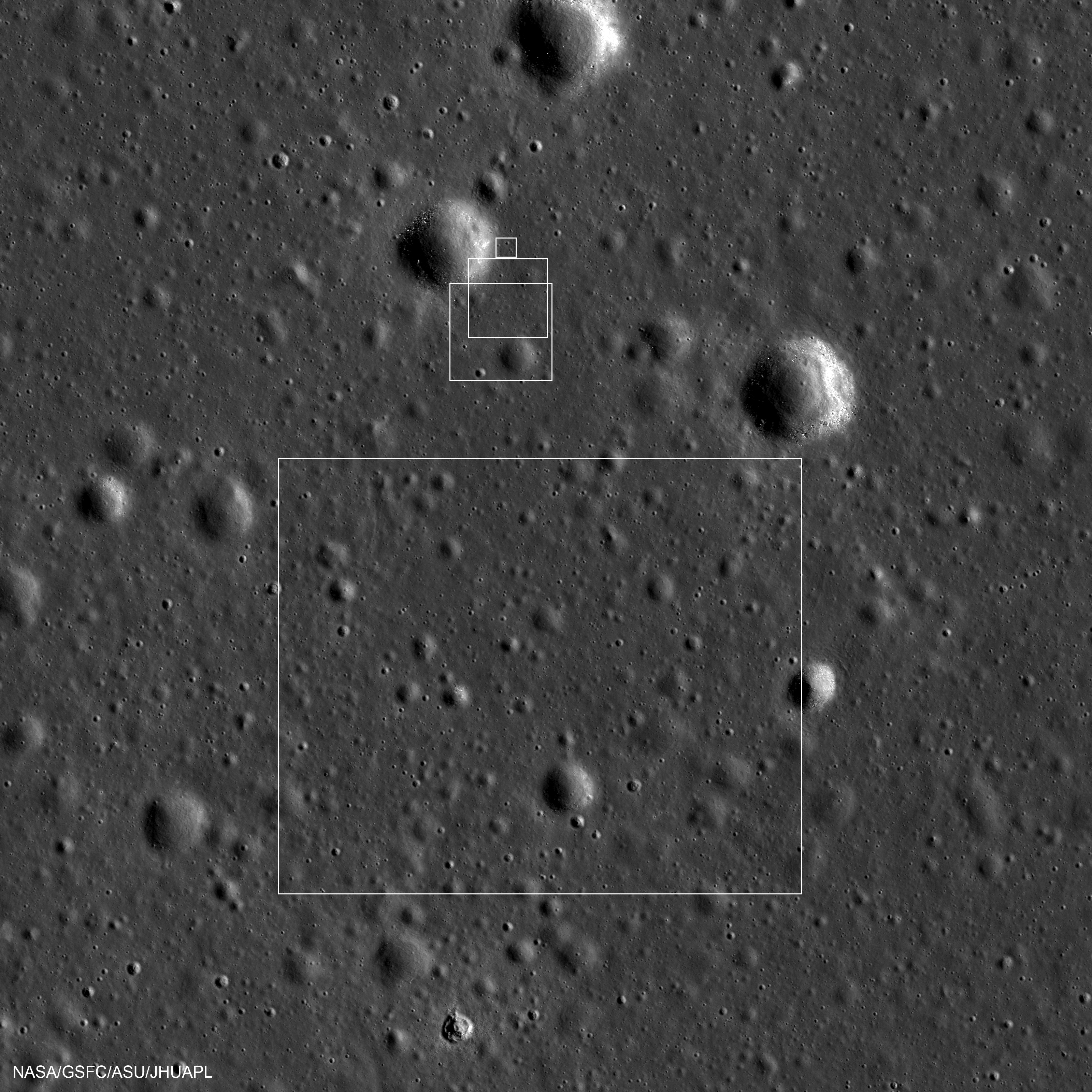
Boxes indicate locations of Chang'e-3 descent images. The spacecraft is probably in, or very near, the smallest box. Image is 4700 meters wide, north is up, NAC M181302794L [NASA/GSFC/ASU/JHUAPL].
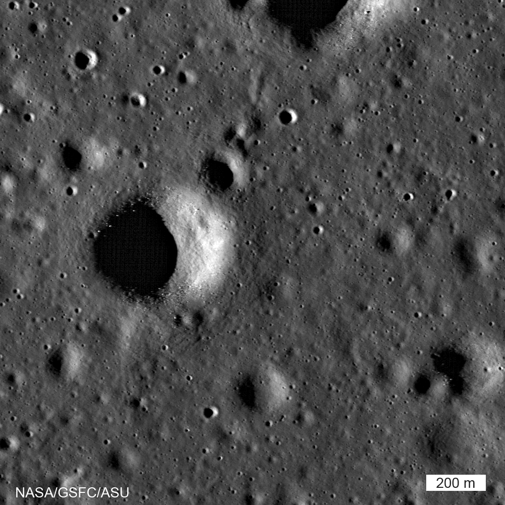
LROC image (acquired 15 July 2009) centered on area seen in descent images acquired by Chang'e-3 as it descended to the surface of Mare Imbrium. Image width 1700 meters, north is up, M102285549 [NASA/GSFC/Arizona State University].

評論
目前還沒有任何評論
登錄後才可評論.