南極人的博客
haha
正文
C:outputzmtcmplt from southnorthpole on Vimeo.
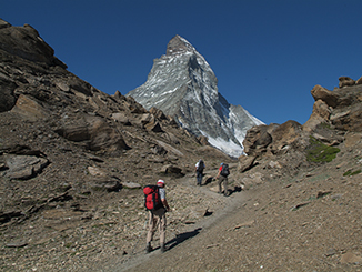
馬特宏峰短程徒步我走的是這個
Hörnliweg
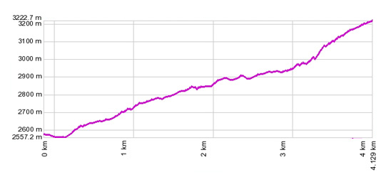
Schwarzsee - Hörnlihütte

A mountain hiking path. The Hörnli Hut is normally the starting point for climbing the Matterhorn.
The special mountain atmosphere of the Hörnli Hut, the ruggedly romantic scenery, the Matterhorn grows ever closer, the idyllic Schwarzsee lake with its chapel "Mary of the Snow".
The special mountain atmosphere of the Hörnli Hut, the ruggedly romantic scenery, the Matterhorn grows ever closer, the idyllic Schwarzsee lake with its chapel "Mary of the Snow".

Difficulty
Difficult
Duration in hrs
2:10
Highest Point
3260 M.a.S.
Length in km
4.1
certified Trail
no
Ending Point
Hörnlihütte (3260 M.a.S.)
Map
1:25000
Schwarzsee可在攬車上馬特宏峰觀景台的第一站下來完成途步會繼續上觀景台.
少女峰地區短程徒步我走的是
1) Grindelwald - Halten - Pfingstegg (可乘攬車上去,我沒乘)
2) Pfingstegg - Bäregg
另外我還乘攬車從Grindelwald上了First ,準備徒步到湖邊看山峰,但天氣不好隻走了一半.
Grindelwald 是少女峰地區的一個小鎮好多人作為遊覽該地區的基地
評論
目前還沒有任何評論
登錄後才可評論.


