


注意:沒有4驅車和豐富的野外生活經驗請勿模仿,因為有生命危險!!!!!
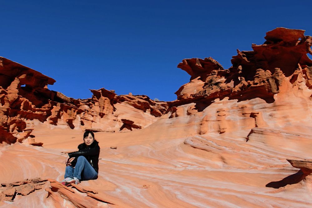
拉斯維加斯向北100英裏隱藏著一個巨大的秘密---小芬蘭。名字很優雅,可是進入的道路,嗨!有路嗎????最後貼路線圖:
先發一段網上的介紹吧:
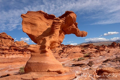
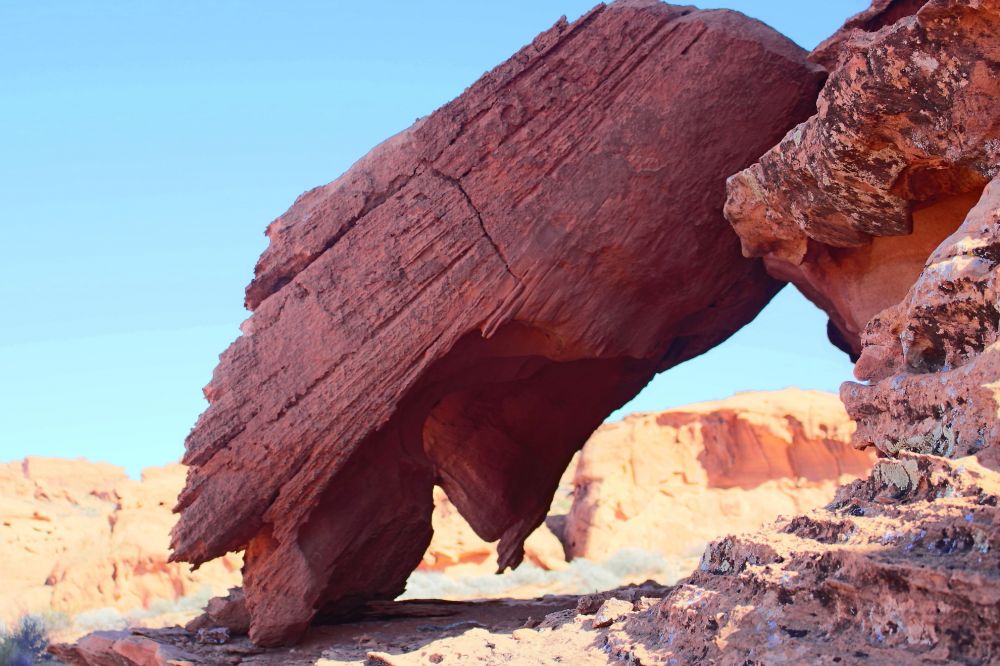
Also known as Devil's Fire or Hobgoblin's Playground, Little Finland is the unofficial name of a remote area in the Mojave Desert near the north end ofLake Mead, where a plateau of red/orange Aztec sandstone has been heavily eroded into amazingly complex and intricate forms, over an area 2,000 feet by 400 feet. The site is similar to other renowned Southwest locations of photogenic eroded rocks, having, for example, similar colors to Goblin Valley, and the same kind of weathering patterns as Fantasy Canyon, but this place is more unusual than either of those two, on account of the complexity and variation of the rock forms, the relatively large area that they cover, and the scenic surroundings; the plateau is backed by taller, more conventionally eroded cliffs to one side, while to the other, the land slopes down towards Lake Mead, allowing long distance views over many square miles of roadless desert, interrupted by some taller hills and other colorful sandstone outcrops.
那天我們在巨大的無人區,感到人類是多麽渺小,很多令人驚異的景點都沒有找到,隻是被巨大的恐懼感包圍。匆匆呆了2小時就離開了,路上車差點卡在岩石上!
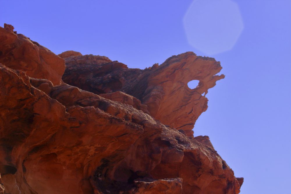
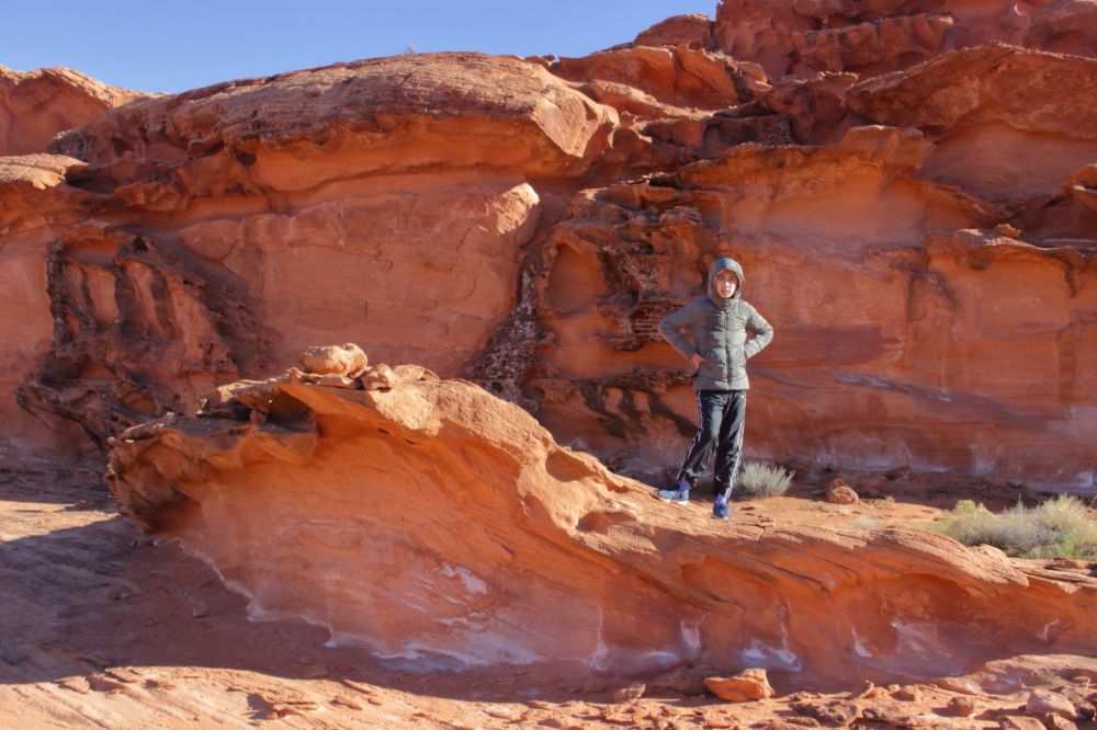
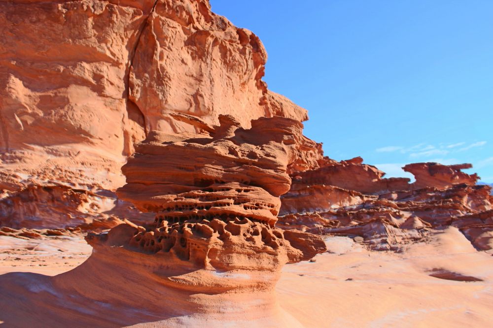
驚濤駭浪:


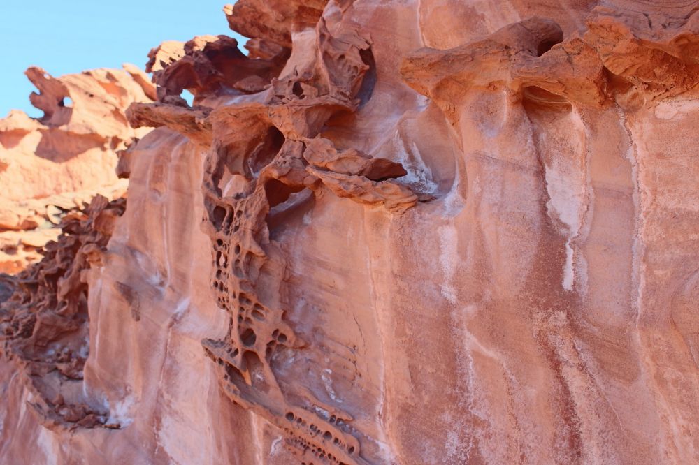
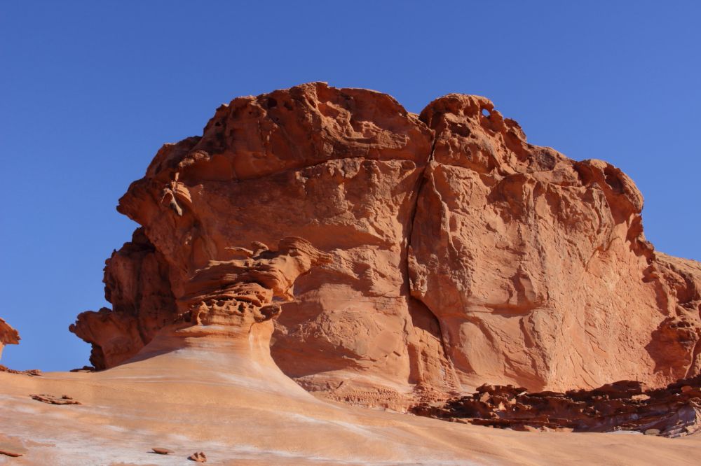
驚豔的紋路

驚豔的紋路:
修行之座:
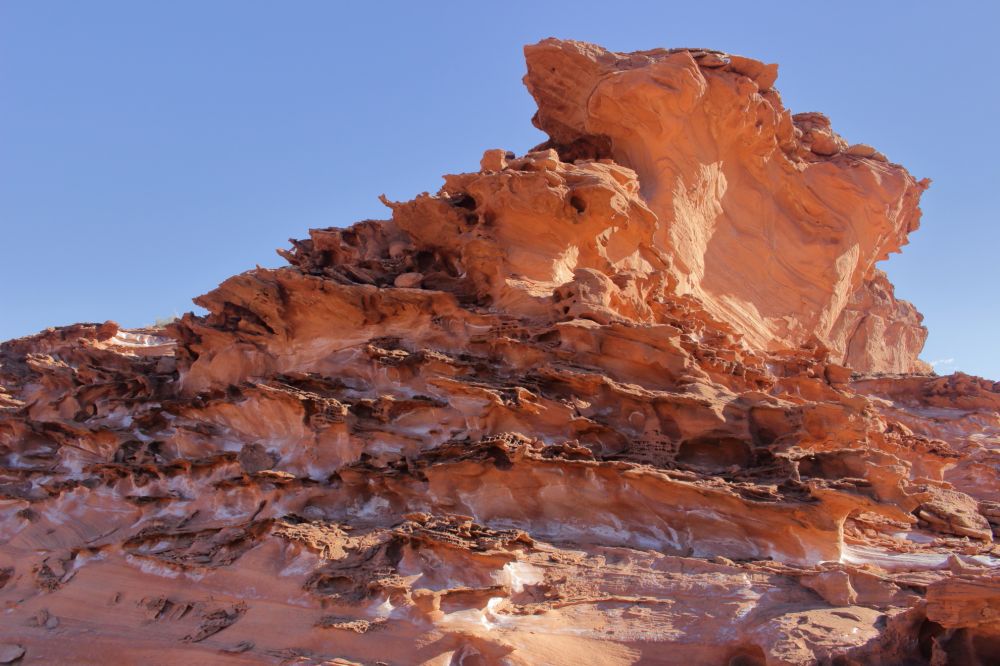
蘑菇花園:
驚濤駭浪:

驚濤駭浪:
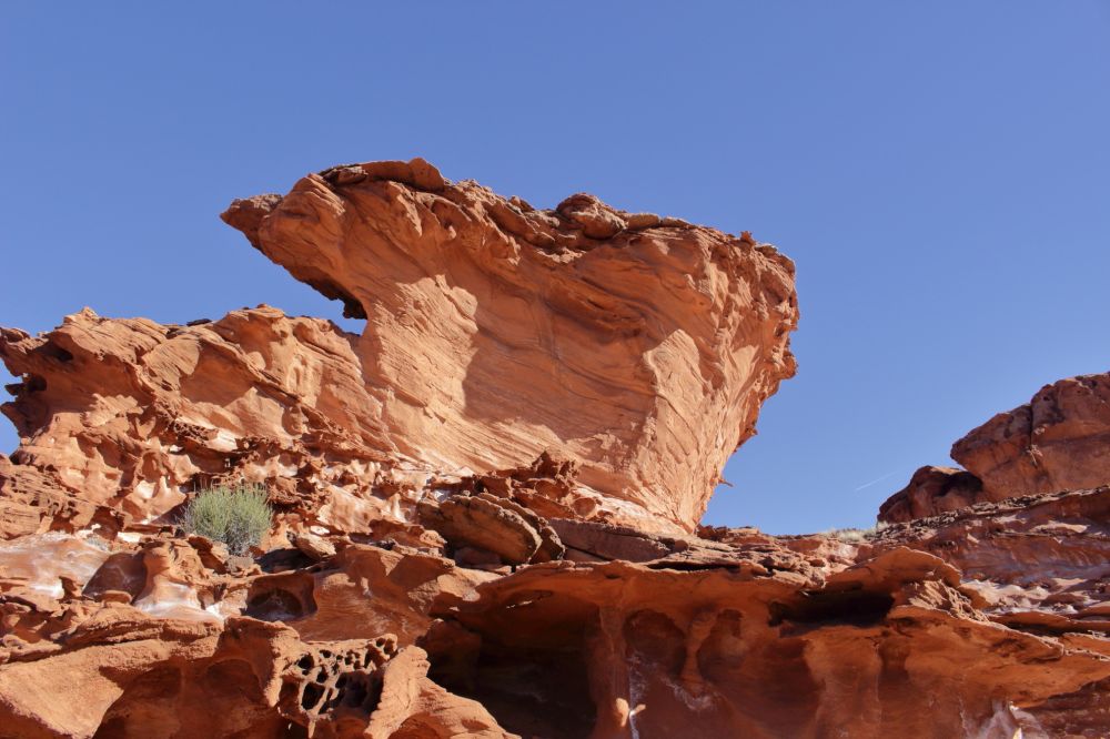
菩提本無座:
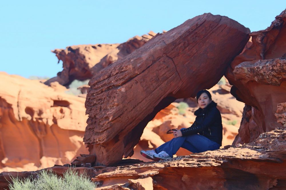
巨無霸漢堡:
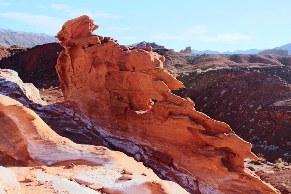
鳳凰之翼:

回程時途徑處女河,驚見處女河的水是紅色的!!!

最後兩張圖的位置沒找到:(網絡圖片)

如果您知道了潛在的危險後,請參考以下路線圖:
Driving Route
The drive to Little Finland, Whitney Pocket, and many other backcountry locations starts along Gold Butte Road, 3 miles from I-15 exit 112. This narrow road runs alongside the east bank of the Virgin River for a few miles, passing no development apart from a melon farm, cultivating one of the few flat areas hereabouts; most of the river is enclosed by low, dusty hills. The road surface is good at first but becomes more bumpy as the route turns southeast, climbing into the hills then descending after a while to a wide plain, reaching a junction after 14 miles. Continuing straight on, the road becomes partially unpaved though still relatively good, as it crosses desert flats, soon coming close to a red rock outcrop, and another just after, beside a second junction, where Black Butte Road forks off southwards. Whitney Pocket is short distance ahead, around a third junction, and here Gold Butte Road bears right (south). Although still a major backcountry route, the surface is now noticeably more uneven, formed of hard-pressed stones, and it becomes steadily rougher. The next intersection is after 7.2 miles, just after the crossing of Mud Wash, where a short track leads southwest to a sinkhole (Devils Throat), just before which another route - Mud Wash Road - forks off westwards, following close to (or directly along) the wash for 6.6 miles. The final section (2 miles) is back east, up a tributary drainage to the base of the Little Finland plateau. This wash has in the past been fenced off by the BLM a little way from the plateau, entailing an extra half mile walk, but the barrier has recently been removed.